Download Virtual Sensor Data

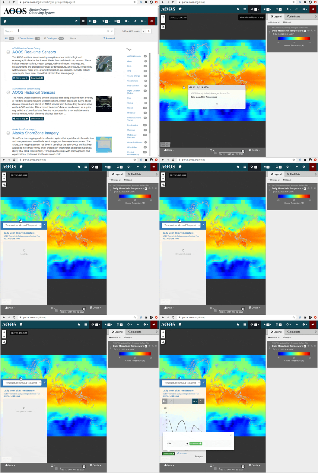
The Ocean Data Explorer provides access to time-series extraction of gridded data, also known as a “Virtual Sensor.”
A map view will open.
Click on an area of interest in the map.
A data view will open.
Once the data load into the chart on the left, scroll down and click
Downloadsto receive a zipped file containing data.csv and metadata.txt for that station and sensor.
For more information, please see the Virtual Sensors section.